Riposto: the start of the Etna East Route
We leave from the sea, from Riposto, a small town that owes its name to the storage of barrels. In the last centuries, the barrels of Etna wine were stored (“riposte”) in the warehouses behind the port before being loaded onto the ships.
Today this port is also called Port of Etna because it lies at the foot of the volcano.
In the middle of the vegetated Etna coast is the Riviera dei limoni, known for its excellent production of lemons, which was the livelihood of the whole region in the last century.
The Etna Villages
Right above there is Giarre, so called for the production of terracotta jars (giare) in the past centuries.
We so leave the riviera dei limoni to get close to Santa Venerina, a small town famous for producing typical local liqueurs such as limoncello, mandarinetto and “Fuoco dell’Etna”, a typical Etna speciality.
Unfortunately, the village has also become known in a sad way: an earthquake on 29 October 2002 (during the so-called perfect eruption that started on 27 October 2002) severely damaged the village, which is why it is also called the “Santa Venerina earthquake“.
As we approach the area around Zafferana Etnea, we come across more and more plantations with typical grapes of Etna: Nerello Mascalese, Nerello Cappuccio, Carricante, Catarratto and Minnella.
East Etna at 700m: Milo Forest
Even before we reach 700 m altitude, we already encounter a special area, the only forest that grows in the nature reserve of Etna Park at this altitude, the forest of Milo, lush and green, thanks to its location in the middle of the side of Etna East, which is particularly rich in rain due to the air currents rising from the sea.
We drive through the delightful village of Milo, the highest village on this side, with its church in the centre, at 720m.
Then we also cross the hamlet of Fornazzoat 824 m, the gateway to the Parco dell’Etna nature reserve. We continue west along the only access road on the entire north-eastern side of Etna, a road with a particularly picturesque name, Mareneve(Sea of Snow), which leads to the ski resorts of Piano Provenzana. The road climbs the slopes of the volcano and we drive alongside old donkey paths and ancient coal roads for about 5 km until we reach Case Pietracannone at 1,150 m above sea level, where we take the off-road route, towards Valle del Bove.
Monte Fontane
We pass the Pietra Cannone mountain hut and dive into the chestnut forest, along an old donkey path. We encounter cherry and pumacolaapple trees until we reach the 1979 lava flow, along which we walk uphill and then see the Valle del Bove.
On an even smaller path we head towards Monte Fontane into the dense vegetation.
Valle del Bove
At the top we come across one of Etna’s monumental trees, the Cerro di Monte Fontane, the oldest specimen of the Quercus cerris oak on Etna East, estimated at 400 years old.
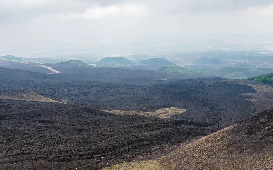
Then suddenly we leave the vegetation on the south side of the summit of Monte Fontane and find ourselves in front of a huge area, like a semi-circular hollow, reminiscent of a cauldron. We are facing the Valle del Bove. As if from a grandstand, we have the opportunity to see a huge wonder of nature, a valley that with its 35 Km² has carved the entire eastern side of the volcano.
We admire a slope full of lava flows that, like immovable stone tongues, testify to how the volcano’s activity has covered this large surface in just half a century.
On 5 April 1971, the first fissures emerged, from which the eruptive activity that created the Southeast Crater developed. One by one, the lava flows entered the Valle del Bove and swallowed the rich vegetation that previously filled the valley. If you look closely at the view, you can still see the previous structure of Etna, which collapsed about 8,000 years ago, giving the valley its shape.
