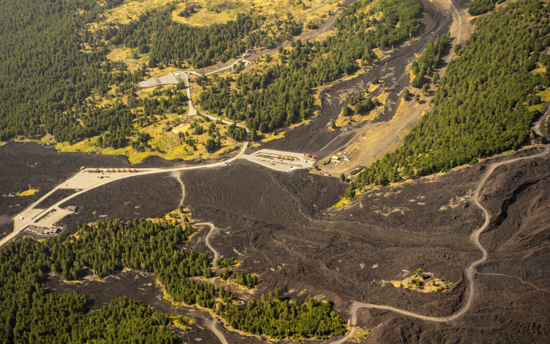
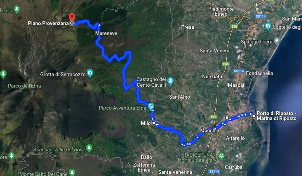
Today we set off on a journey from the sea, more precisely from Riposto, also known as the harbour of Mount Etna, up to Piano Provenzana on the north side of Mount Etna, where the roads end and you can only continue on foot.
This route takes just under an hour by car. You’ll be surprised what there is to discover on this journey!
Riposto
We start our journey in the fishing village of Riposto, right by the sea. Although there is a typical Mediterranean flair here on the coast, we are already on Mount Etna, the largest active volcano in Europe.
Mount Etna stretches from Catania in the south to Randazzo in the north. It is 65 kilometres from north to south and 45 kilometres from east to west. Etna therefore covers a huge area of around 1200 square kilometres. This makes it look very flat despite its height of over 3300 metres.
The harbour of Riposto is the starting point for fishing and tourist boats, but is also used for commercial trade. Due to its proximity to Mount Etna, it is also known as the “harbour of Mount Etna”, Porto dell’Etna.
Giarre
Immediately after Riposto is the town of Giarre. In addition to the cathedral, there are beautiful palazzi to admire and the shopping streets entice visitors with a wide variety of offers.
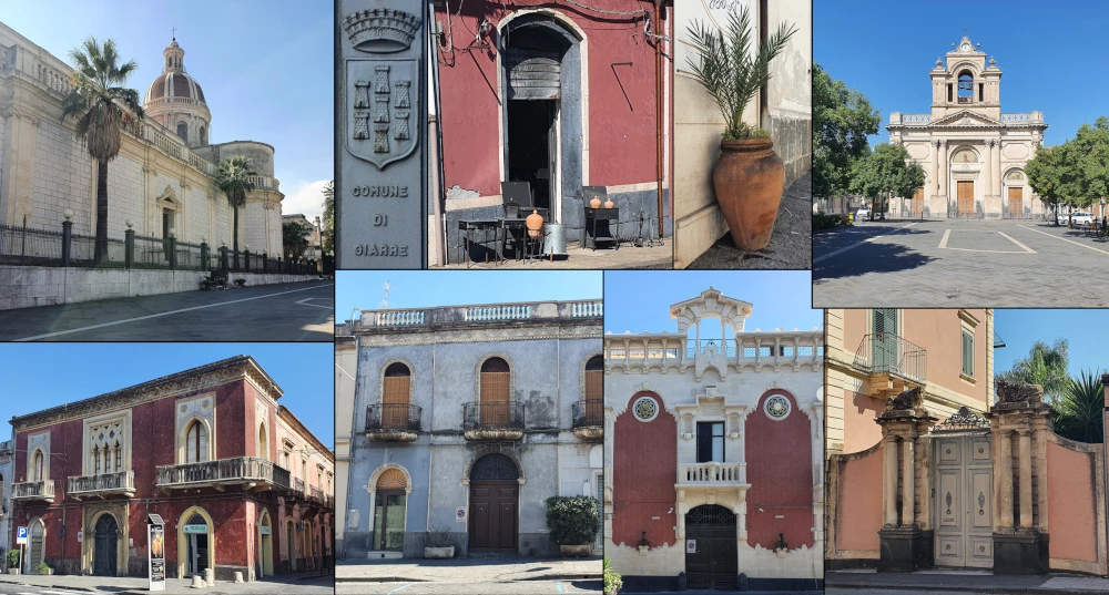
The pictures show clockwise: cathedral, city coat of arms, typical crafts of the region: wrought iron and clay jugs, which also gave the city its name (giara = clay jug), church of San Francesco D’Assisi al Carmine, palazzi.
Both towns are located in the east of Mount Etna, below the huge Valle del Bove valley. This valley was formed around 9500 years ago by the collapse of the summit of Mount Etna. From Giarre, you can see what the structure of Mount Etna looked like at that time: if you follow the edges of the valley and extend them, you can easily imagine that the summit at that time was much higher (around 3700 metres) compared to today.
The rock masses rolled into the sea during the collapse. This is why the coast below the Valle del Bove looks different: here the rocks predominate; further south and north, lava flows have reached the sea.
The route continues uphill with many bends until we arrive in Milo.
Milo
Milo lies at an altitude of over 700 metres and is the last municipality we drive through on our way. Most of it is already located in the Etna Nature Park (Parco dell’Etna).
In the small village with around 1000 inhabitants, you can visit the church and from the terrace in front of the church there is a wonderful panorama of Taormina and Castelmola and along the coast.
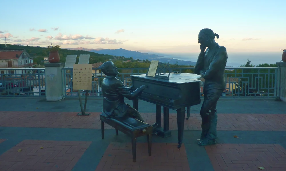
The statues in the square in front of the church in Milo depict the musicians and songwriters Franco Battiato (1945 – 2021) and Lucio Dalla (1943 – 2012), who shaped Italian music. Both lived (temporarily) in Milo.
From here you can also easily recognise the border between Mount Etna and the rest of Sicily. The Etna area is very green on the eastern side due to the abundant rainfall, while it is brown all around.
Due to this special climate on the eastern side, plants grow here that are otherwise only found in northern Italy. If you look closely, you will discover apple trees, cherry trees and much more.
Fornazzo
In Fornazzo, a district of Milo, we turn left onto the Mareneve road: mare, sea and neve, snow – from the sea to the snow (on Mount Etna). We now follow this road for 15 kilometres until we turn off towards Piano Provenzana, the tourist centre on the north side of Mount Etna. Via Mareneve continues for a total of 30 kilometres to Linguaglossa in the north-east of Mount Etna.
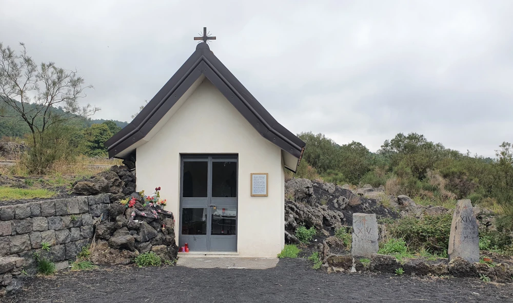
Shortly after Fornazzo, there is a small chapel on the right-hand side of the road (view on Google Maps), which has an interesting history. The “Sacro Cuore di Gesù” (Sacred Heart of Jesus) chapel was built in gratitude for the fact that the village was spared from the lava flows of 1950 and 1971. In 1979, another lava flow threatened Fornazzo and destroyed several houses outside the village. The lava flow reached the chapel, lay on the walls of the building and made a hole in the wall. However, the lava did not penetrate the chapel and did not destroy it. A miracle for the people in the neighbourhood! What’s more, the lava flow stopped and did not destroy Fornazzo.
Lava flows and birch forest
After Fornazzo, lava flows begin to rise to the left and right of the road. The age of the lava flows can also be recognised at this altitude by their colour: new lava flows are black, after approx. 10 years a lichen begins to grow on the lava, which covers the lava in a greyish colour (further up this lichen no longer grows).
The Via Mareneve takes us higher and higher through forests of chestnuts (castagne, chestnuts eaten roasted with salt in Sicily from November), oaks and pines.
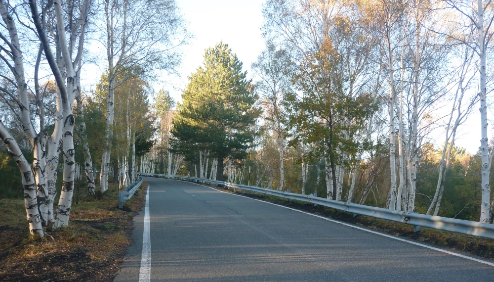
Shortly before our destination, we discover another special feature of Mount Etna. Shimmering white trunks stand to the left and right of the road. We drive through a forest of Etna birch, an endemic species that only grows on Mount Etna (Betula aetnensis).
When we turn off to Piano Provenzana, we also come across the lava flow from 2002 for the first time, which we will follow until the end of our journey.
Piano Provenzana
After 1810 metres in altitude, we have reached our destination. Although Piano Provenzana is the tourist centre on the north side, it is very quiet here compared to the south side. The large crowds of tourists prefer to take the cable car on the south side of Mount Etna. There are only a few small souvenir stalls and bars here, so food and drink are taken care of. As a souvenir from Sicily, you can buy typical Etna products here:
- Honey, the gold of Etna; the somewhat tart chestnut honey is typical.
- Cream and pesto made from pistachios, which grow in the west of Mount Etna (where the climate is completely different).
- The “Etna fire”, a high-proof herbal liqueur.
The tourist centre of Piano Provenzana was completely destroyed in the 2002 eruption and then rebuilt. The only remnants of the old centre are a restaurant, which was destroyed down to its foundations, and the top of the roof gable of a hotel that protrudes from the lava flow.
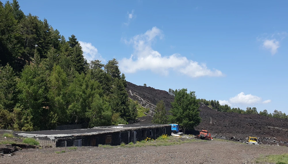
The lava flow narrowly missed the restaurant, but it was completely destroyed by the falling lava bombs.
From here we can see the lava flow of 2002 pouring down the slope and splitting the forest; the summit craters loom behind us.
Several hiking trails start in Piano Provenzana. If you want to immerse yourself even further in the black lava desert, why not join us on the North Craters Tour? On this varied tour, we follow the lava flow from 2002 and walk up to the huge lateral craters that were formed back then.
